
Spotsylvania Courthouse Area Guide: Roads, Parks and History

Quick answer: The Spotsylvania Courthouse area is the county's historic seat, centered on Courthouse Road. It combines a National Register historic district, the historic county courthouse, the Spotsylvania Court House battlefield trails, and county parks such as Keswick and Legion Fields. Here is how the roads, parks and history fit together.

When people in Spotsylvania say "the Courthouse," they usually mean the area around the county's government center rather than one building. It is a mix of old and new: a small historic village, a large battlefield landscape, and newer homes and parks along the main roads. This guide sticks to what the county, the state and the National Park Service publish.
How the courthouse ended up here
Spotsylvania's court did not start at this spot. The county's history page says the court met at Germanna in 1722, moved to Fredericksburg in 1732, then to the Old Courthouse in 1778, and finally to the present site in 1839 (Spotsylvania County).
The courthouse itself was completed in 1840 by Malcolm Crawford and William Phillips. The county says it was repaired in 1870, rebuilt around 1901 in cream brick that kept the original Doric columns, and expanded with a wing in 1964. Its bell was cast in 1880 (Spotsylvania County).
The historic district
The village around the courthouse is a recognized historic district. Virginia's Department of Historic Resources lists the Spotsylvania Courthouse Historic District on the Virginia Landmarks Register in January 1983 and the National Register of Historic Places in September 1983 (Virginia DHR).
DHR notes that four buildings from the era of the 1864 battle still stand in the district: a tavern from about 1800, two antebellum churches and a farmhouse from about 1840 (Virginia DHR). The county offers a self-guided walking tour of the district with wayside signs, plus outlying stops you can drive to (Spotsylvania County historic district tour).
If you are looking at an older property inside the district, it is worth asking early whether any local review applies to exterior changes, and getting that answer in writing from the county.
The battlefield next door
The Spotsylvania Court House battlefield is part of the National Park Service battlefield park that also covers Fredericksburg, Chancellorsville and the Wilderness. NPS says the first clash here came on May 8, 1864, at Laurel Hill across Brock Road, and the fighting at the Bloody Angle on May 12 lasted more than 20 hours (NPS Spotsylvania battlefield).
A few things to know before you go (NPS Spotsylvania battlefield):
- The driving tour has 8 stops, including the Bloody Angle, the Harrison House and the McCoull House Site, and a final stop on Fredericksburg Road (NPS Spotsylvania battlefield).
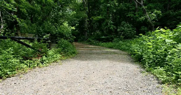
- The Bloody Angle Trail is 1.1 miles, and the Spotsylvania History Trail is a 5.7-mile loop that passes much of the area's 14 miles of earthworks (NPS Spotsylvania battlefield).
- The exhibit shelter on Grant Drive is staffed seasonally, and the park grounds are open daily from sunrise to sunset (NPS hours).
NPS says hiking in the park is fee-free, dogs are welcome on a leash no longer than 6 feet, and the park roads at Spotsylvania are popular for walking (NPS hiking). Our battlefield trails and access guide covers all four battlefield units in more detail.
County parks in the Courthouse area
Two county parks are close to the courthouse.
Keswick Park sits near Lake Anna Parkway and Brock Road. The county lists 2 small diamonds, 2 soccer fields, walking trails, a playground, a picnic shelter, 2 lighted tennis courts lined for pickleball, and more than 180 parking spaces. The parks office number on the listing is (540) 507-7529 (Keswick Park).
Legion Fields Park is a 24-acre community park on Courthouse Road (Route 208), with lighted diamonds, a multi-purpose field and a track (Legion Fields Park).
Roads and getting around
Courthouse Road (Route 208) is the main spine of the area, and Legion Fields Park sits right on it (Legion Fields Park). Brock Road runs past Keswick Park and the battlefield, where the first fighting took place across it at Laurel Hill (NPS Spotsylvania battlefield). Keswick Park itself is listed near both Lake Anna Parkway and Brock Road (Keswick Park).
If you are considering newer construction along the corridor, our Route 208 and Courthouse new homes checklist covers zoning, road plans and utilities. For shopping, see our guide to Spotsylvania Towne Centre and Cosner's Corner.
FAQ
Where is the Spotsylvania Courthouse historic district?
It is the village around the county courthouse, which the county says has been at its present site since 1839, with a walking tour and wayside signs (Spotsylvania County).
How long are the trails at the Spotsylvania Court House battlefield?
NPS lists the Bloody Angle Trail at 1.1 miles and the Spotsylvania History Trail as a 5.7-mile loop past much of the earthworks (NPS Spotsylvania battlefield).
Can I bring a dog to the Spotsylvania battlefield?
Yes. NPS says dogs are welcome on the trails on a leash no longer than 6 feet, and hiking in the park is fee-free (NPS hiking).
What is at Keswick Park in Spotsylvania?
The county lists ball diamonds, soccer fields, walking trails, a playground, a picnic shelter and lighted tennis courts lined for pickleball at Keswick Park, near Brock Road (Keswick Park).
Thinking about a move near Spotsylvania Courthouse?
If you want help weighing a home's location against the historic district, the parks and your daily drive, call or text Ron Chronister, REAL Broker, at (540) 300-4967. You can also start from the Spotsylvania area page or request a selling consultation.
Categories
Recent Posts




GET MORE INFORMATION